Home / Mountains / Utsukushigahara
Utsukushigahara 美ヶ原

| Elevation | 2,034 m (6,673 ft) |
|---|---|
| Location | Nagano, Japan |
| Region | Chubu |
| Famous Mountains list | No. 61 of the 100 Famous Japanese Mountains (Nihon Hyaku-meizan) |
| Coordinates | 36.2258° N, 138.10744° E |
Utsukushigahara One of the the 100 Famous Japanese Mountains.
Overview
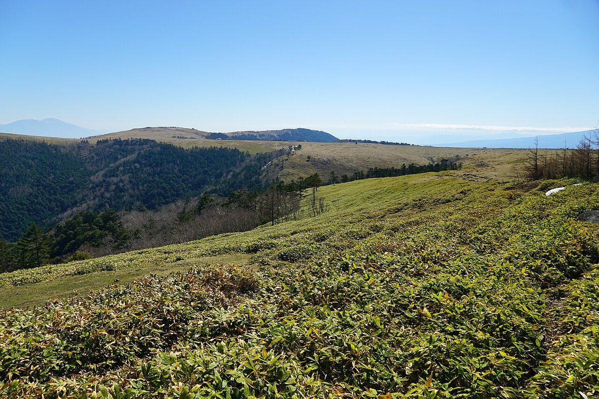
It's the fourth-century volcano that exploded near the west of the Fossa Magna. Although it was once thought to be a volcanic eruption and its lava base, it is now interpreted as an igniting area of a volcano with a formation of Fukuyama rocks. The highest peak is the King's Head, 2.34 m. There are other peaks, such as the king's nose, 2,088 m). At the top of the mountain, it is a flat terrain that serves as a pasture for cattle called Utsukushigahara. The Utsukushigahara ranch has about 300 cattle pastures from May to October. The top of the mountain is the grasslands, which are spectacular, but you can see nearby Mount Mount Tateshina. You can stand near the center of Nagano and look across the province. From this, it's the key to broadcast and communication. In addition, Matsumoto, Miyagi Matsumoto, Miyagi Matsumoto, has received from Japan's mail address, Utsukushigahara, so mail can not be sent from outside the country to this location.
Development history
Regarding the term "Utsukushigahara," the first view in the book is called "The Order of the Faith." It was not until 1941, when Yoichi Kiyoro set up a record of climbing in Mountain Mountain, a news report for the Japanese Mountain Council. The foothills have been used more as pastures than at peace. In the Edo period, the view of Mount Ontake has made it the mountain of the belief in Tsubagakure. Each statue with the king's nose is pointed in the direction of Mount Ontake and is the object of his belief. - The Utsukushigahara ranch was opened and use began as a serious ranch. - A Yamamoto house opened on the top and many climbers came. The Tower of Beauty, which is a symbol of Utsukushigahara, was built as a roadmark and shelter for escape. - The forest road to the top was opened and buses were driven to the top, and antennas for NHK and SBC broadcasts were built on the king's heads. - The Venus Line opened and the Utsukushigahara Museum became a tourist site available for private cars. - The opening of the NaganoZZQ064X Natural Protection Center.
Tourists
The Panorama Coast is an unpaved road through an elevated pasture, but traffic in general cars is regulated. It's a course of about two hours on foot. On behalf of the early summer wrings and the late summer fireworms, various kinds of flowers can bloom along the road from June to September. From the salt hole to the king's nose is parallel to the Panorama Coast and has a "Alps' exclusive walking tour." We can hope for the North Alps closer. NaganoXZX064X Natural Protection Center, exhibition room, cafeteria store "Santa" The Utsukushigahara Museum is about six kilometers away by a straight distance. Where salt is placed on a stone and where salt is given to cattle. The tower of beauty is at Utsukushigahara. It was built in 1954 as a bell tower, the bell tower for climbers when the sight was poor. The current tower was rebuilt in 1984 (59) and has become a symbol of the high ground. A 6-foot tower made of pumice stone from Utsukushigahara provides shelter inside. The tower is inscribed with the poem "Utsukushigahara lava base" written in the book of the Hyung Poetry book of Sugisaki. Every year on April 25th, a mountain festival is held in front of the tower. The Utsukushigahara Museum. The Utsukushigahara hot springs are found at the foot of Mount Utsukushigahara.
King's head
Utsukushigahara at the highest peak, altitude 2,034 m. There's a royal hotel with many other towers.
The king's nose
At altitude 2,08 meters on the tip of the king's western ridge. There's a rock Buddha about 20 minutes from the king.
Cowscow Mountain
It's a mountain on the east side of Utsukushigahara and altitude 1,990 m. It's about ten minutes from the Utsukushigahara Museum on the foot of the mountain, and about ten minutes from the Yamamoto's Home in the south.
It's the cabin around here
The King's Home. The King's Hotel. Utsukushigahara Sakura water cottage. The mountain house, Pitica. It's called the Utsukushigahara Castle YH. Utsukushigahara Highland lodge. The Utsukushigahara Takahara Hotel. Yamamoto's hut. It's Yamamoto's hut.
Broadcasting station
There's a broadcast station on the border between Matsumoto and Takada City. It's a broadcast area within Nagano. NHK Osaka Broadcasting Station's headquarters is located at a transmitter at the top of the mountain, followed by Hokkaido (HBC) Because of the high altitude of the transmitters, there are areas that can be picked up by spill overpasses, such as Kanto and Tohoku in the surrounding area and Niigata. At first, he saw to it that SBC broadcasts could be delivered effectively before the opening, and he worked to work with the NHK Broadcasting Agency in front of the opening. By following other agencies as well, the entire agency's transmission center is here. It was chosen to cover roughly the north and south, including Nagano and Matsumoto under Nagano. It's very efficient because it covers almost every area of the wide Nagano.
The ground-wide digital John broadcast facility
Each station and station continues to use existing analogs, but only SBC digital television uses existing analogs, and they share NHK's transport facilities.
The ground analog TV John broadcast facility
On July 24, 2011, the ground-wave analog broadcast came to an end, and the whole area was abolished. (NHK had the BSWM broadcast station, Utsukushigahara Broadcasting Station, the previous year, as the JOK-TV station in Tokyo, JOK-TV, for covering Nagano City.) There's also a Utsukushigahara in Matsumoto, but there's a lot of cover in the mountains. TV province has a +10 kHz offset. The transmitter is located at the highest point of television transmission facilities in Japan.
FM Radio Broadcasting System
The Utsukushigahara, in addition to the station's transmission facilities, has a radio network of government agencies and business radios.
Railroad
JR TOEKYA:
Road
Nagano Road 464 Utsukushigahara Park Westside. Nagano Car Road: Konsaka Interchange.
Utsukushigahara Highland tourist bus
The only way to get there is to get there.
Utsukushigahara Straight Bass
Strategy - Remembering Hill - Utsukushigahara Natural Protection Center, Utsukushigahara Natural Protection Center and Utsukushigahara Museum are about seven kilometers away. Only Saturday holidays between June and September each year. (Everyday from the middle of July to the end of August) Tour de Utsukushigahara Bicycle Race Day is off. Starts running on June 16, 2018. The first year was from June 16 to September 30s. It was only a Saturday celebration from June 16 to September 30s. But it was a holiday from July 17 to August 31st. It's run by an Alpico taxi. Presets. At Matsumoto Station, the port of the Alps has been changed from the traditional central station from the 2024 season to the 31st temple from the west. Although it used to be a temporary reservation, it was reserved from the 2024 season, and it was scheduled for one month before leaving on the net for the flight this day, and it has not accepted a telephone reservation. In addition to the Internet reservation in 2025, the fare payment was changed only to the payment of the cash.
Other bus routes
A thousand-circuit bus from Takada Station: Matsumoto bus from the terminal known as Alpico Electrica: Matsumoto - Utsukushigahara High Museum Platform Station or Utsukushigahara High School of Art.)
The neighboring mountain
Mount Kirigamine.
Text adapted from the Japanese Wikipedia article 美ヶ原, whose full text was translated into English for this guide by its contributors, licensed CC BY-SA 4.0. Elevation and location facts cross-checked with Wikidata (CC0) and the 100 Famous Japanese Mountains list (Japanese Wikipedia, CC BY-SA 4.0).