Home / Mountains / Mount Washiba
Mount Washiba 鷲羽岳
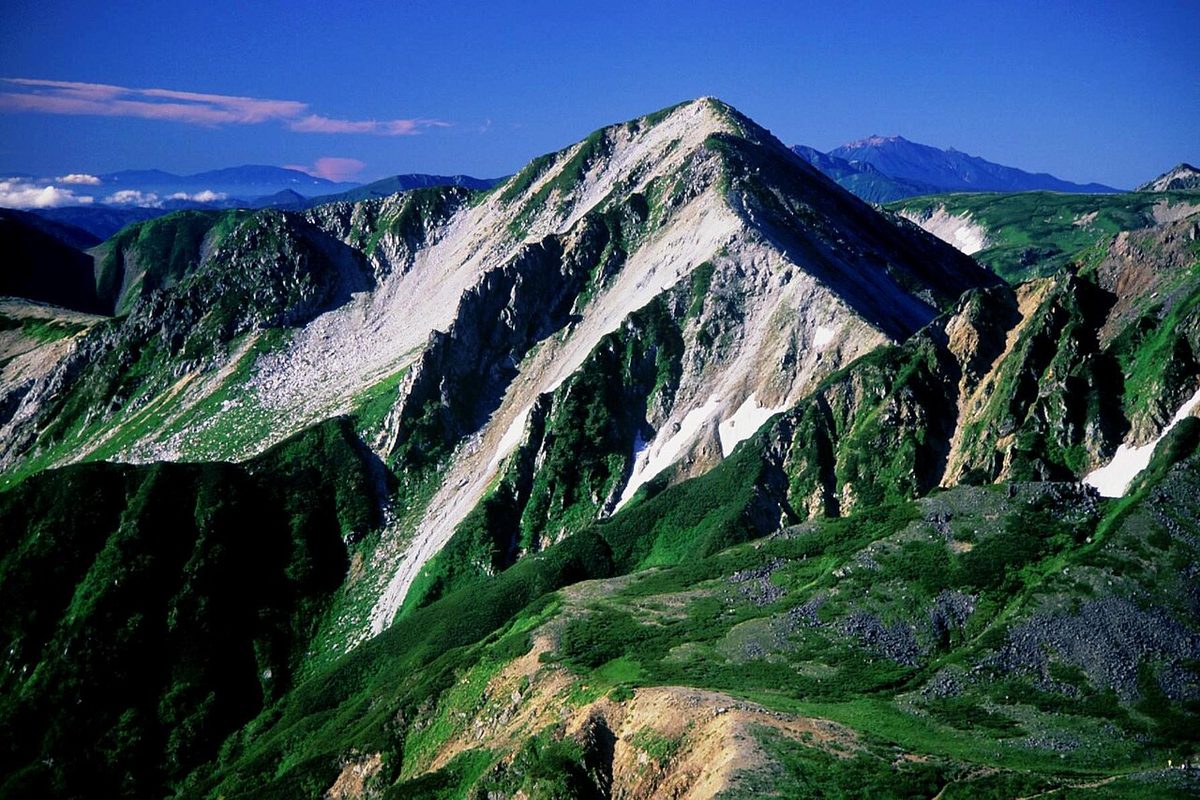

| Elevation | 2,924 m (9,593 ft) |
|---|---|
| Location | Nagano, Toyama, Japan |
| Region | Chubu |
| Famous Mountains list | No. 53 of the 100 Famous Japanese Mountains (Nihon Hyaku-meizan) |
| Coordinates | 36.40306° N, 137.60528° E |
An eagle's volcano on the south slope of Mount Washiba is a volcano at the deepest in the North Alps. The mountain range has been set up as a special protected zone on December 4th. It's also selected for the 100 Famous Japanese Mountains. A trigonometric point is set on the top of the mountain. The name of the score is, "Singing." His location is Toyama.
Position
It's located at the source of the Black River. It's on the track on the Kusakagi Line, called the "Russinzagi" line, and because of the depth of the mountain, it often takes several days to climb it. The top of the mountain is a forest-sized high pine belt with a good view and a good view of most of the mountains of the sea. The north side of the mountain consists of a day-day site, and the south side of the mountain is made up of flowering green rocks.
Eagle Falls volcano
There's an eagle pond about 450 meters southeast of the summit. It's a volcano formed on the southeast slope of Mount Washiba, and the eagle's crater has a bright crater shape. They make up the eagle and the cloud and the volcano, along with clouds and other things.
The history of volcanic activity
It's been active since 120,000 years ago, and it's been pouring the lava flow of the day's site to the northeast. There is also the estimate that the craters may have exploded within the past 10,000 years because of their vivid terrain. In fact, it was found that in about 2300 B.C., it was sulfur - sulfur - sulfur - sulfur - and in the Eagle pool, about the B.C. But it's not specified as a active volcano specified by the Weather Service.
The exhalation action of Ishizawa
In recent years there have been frequent observations of steam currents rising to hundreds of meters or more high in the sulfur - sulfur - sulfurs in the southeast of the eagle's pond. The same phenomenon took place about once every 3 - 5 years before 2020. At least there's an eyewitness story around 1979 and the early '90s. This exhalation came from a black pond about 20 meters in diameter that shows up at indefinite intervals. But it disappeared around '95. In an article dated 2000, it was written that there would be continued vigorous fluoride activity and that it would generate steam about once a year. On August 31, 1920, there was a fever in almost the same place, and it was observed several times after that. Of course, September 28 was a relatively large day. There were exhilaration and hot springs on September 21st, 2021. In the peat around the eagle's fire, you can see an eagle's fresco, a dusty clay tefra.
The history of mountain names
The name of the mountain comes from the mountains that are viewed from the south side of Sano-yang. The eagle usually looks like an eagle with wings. This mountain was named East Mount Washiba or Dragon Realm, and today Miyoshi Shizura was called Mount Washiba. From the post-war period, to the post-war regime, the majority of them have been investigated by the backseats of Kasai, and in 1697 the names of the mountains and the landscapes of Ebino Hanoi were painted. In particular, this present-day trinitarian order was under investigation from the importance of three borders. In the diary of the mountain range (in 1810) of the Eurasian culture, it is written: "In the seventh year of culture, When Koshima and the High Guard of the Japanese Mountain Society climbed from Japan as guides up the upper border, this mountain area was a virgin land for them. I didn't know the name of the person on the other side of the mountain at this time. It was explained by the Japanese hunter who ridiculed them and called them Hanoi's masturbator. In a plot of 50,000th of what was then known as the Joint Chief of Staff, it was written as Mount Washiba by Mount Washiba. So he insisted that the site of the Japanese Mountain Council should not be examined for land measurements and correct the map. The result has been a revision of the 1930's.
Climbing
During the summer of 1907, Ichimura, in search of undiscovered depths in the remotest and most remote regions of the Black River, climbed from Highland Valley to Mount Washiba on the current so-called subsidiary course.
The climbing route
It's on the Mount Yari course, followed by Mount Yari, and there are many other routes. This is an example of it. Ginzanjiang - Bungna ridge (in the north): Akira, Japan, Japan, Japan, Japan, Japan, Japan, Japan, Japan, Japan, Japan, and Japan. Iseshima Hotel.
It's the cabin around here
On the mountain road around, there are several cabins and camps. The nearest cabin to the mountain is the village of Sanoyama.
The river from the source stream
The river from which this mountain comes is as follows. All of them flow to the Sea of Japan. The saddle section between Mount Washiba and Sasang-yang has become a drain between the Black River and the Takase. Black River. I'm sorry, I'm sorry.
Text adapted from the Japanese Wikipedia article 鷲羽岳, whose full text was translated into English for this guide by its contributors, licensed CC BY-SA 4.0. Elevation and location facts cross-checked with Wikidata (CC0) and the 100 Famous Japanese Mountains list (Japanese Wikipedia, CC BY-SA 4.0).