Home / Mountains / Mount Shibutsu
Mount Shibutsu 至仏山
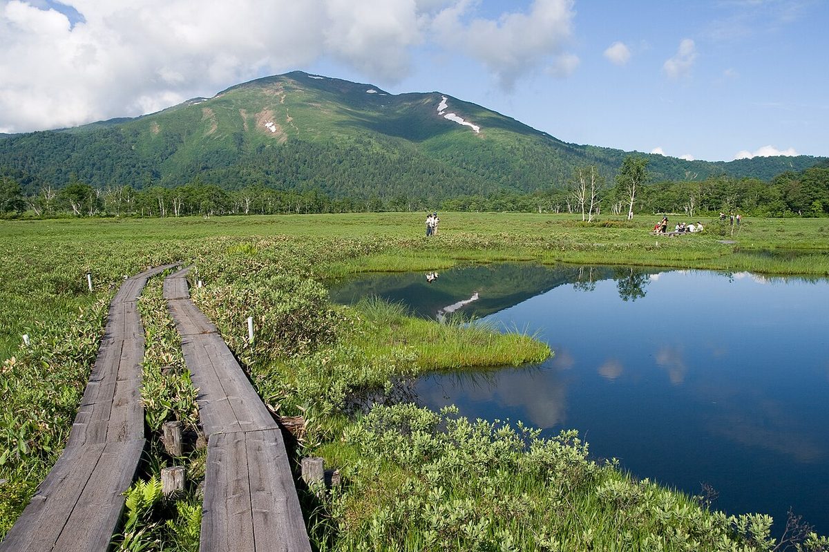

| Elevation | 2,228 m (7,310 ft) |
|---|---|
| Location | Gunma, Japan |
| Region | Kanto |
| Famous Mountains list | No. 29 of the 100 Famous Japanese Mountains (Nihon Hyaku-meizan) |
| Coordinates | 36.90347° N, 139.17325° E |
The mountain located on the west edge of the Suseharahara is one of the main peaks of Sugishi. There's a "Mount Shibutsu" on board. I belong to Hase National Park.
Overview
The mountain formation was formed by the rise of the rose rock. The mountain plants are first known for their adaptability to rock formations, such as the ossuary and the remaining ice-driven plants, and so on. In 1929, Botanists Nirvana was collecting the Osechi at Mount Shibutsu. The east side of the main line is a special protected area and national monument, and the west is designated as Gunma environmental conservation area. Deforestation of vegetation and bare land around the mountain road has been challenged, and the mountain roads have been closed down from 1989 to 1996, due to the agreement of the U.S. In the year 1997, he resumed his use of mountaineering in the year 1997. However, he has not recovered his vegetation, and he is conducting a closed snow trail from 1998.
The course
There's the following course. Dove - zXQ040X peak distance 4.5 kilometers, altitude 637 meters). Mountain Nose - Mount Shibutsu peak distance 2.9 kilometers, altitude 828 meters). (Excluding the eastern slope from the mountain nose to forest limit, it is dangerous to go down because of the slippery lassies, and down because plants are more vulnerable to walking on the ground, and up and down, except for the forbidden noses and forest limits.) In addition, there is no toilet in Mount Shibutsu. Also, I can't get my cell phone around Mount Shibutsu.
Consumption regulations
(The snow condition varies from May 7 to June 30 as a result of the ongoing snow conservation) The mountain control is under control, and the climb is possible after the opening of July 1st. The closing of the mountain road has been extended since 2010.
Traffic
The train bus, the train bus, the train bus, the train traffic bus, and the train bus from the Hakita Tokita train station on JR. Car I.E., Numada I.V., National Road, 401. We need to replace the porter with a bus or a taxi because our car regulations take place during the climbing season, the land, and peak.
Neighborly mountains
I don't know. Mt. Fuji. Mount Hiragatake. Mount Hotaka.
Text adapted from the Japanese Wikipedia article 至仏山, whose full text was translated into English for this guide by its contributors, licensed CC BY-SA 4.0. Elevation and location facts cross-checked with Wikidata (CC0) and the 100 Famous Japanese Mountains list (Japanese Wikipedia, CC BY-SA 4.0).